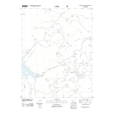
2011 Map of Elevenmile Canyon
USGS Topo · Published 2011About this map
Elevenmile Canyon Reservoir and the winding course of the South Platte River dominate this landscape in the heart of Park County. The map documents a rugged topography defined by numerous gulches, such as Springer Gulch and Sledgehammer Gulch, which drain toward the central canyon. Human presence is marked by a series of long-standing family ranches including Abell Ranch, Lewis Ranch, and Hartsel Ranch, reflecting the area's enduring ranching heritage. Local history is further grounded by the Rocky Cemetery and legacy landmarks like Lone Chimney. Infrastructure for water management and recreation is evident through the Elevenmile Canyon Dam and various campsites like Wagon Tongue Campground, showing how the land has been managed for both utility and public use in the early 21st century.
Find a feature on this map
53 named features on this map. Tap any name to fly to it.
Don’t see what you’re looking for? This feature index may not catch every label — zoom into the map to look around manually.
Map Details
Editions of this 2011 Elevenmile Canyon Map
This is the sole edition of this map. No revisions or reprints were ever made.
Other maps of this area

1893 · Platte Canyon
USGS Topo · 1:125,000

1894 · Pikes Peak
USGS Topo · 1:125,000

1901 · Pikes Peak
USGS Topo · 1:125,000

1953 · Denver
USGS Topo · 1:250,000

1954 · Pueblo
USGS Topo · 1:250,000

1956 · Tarryall
USGS Topo · 1:24,000

1956 · Hackett Mountain
USGS Topo · 1:24,000

1956 · Lake George
USGS Topo · 1:24,000

1956 · Elevenmile Canyon
USGS Topo · 1:24,000

1956 · Glentivar
USGS Topo · 1:24,000