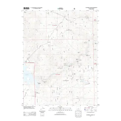
2013 Map of Elevenmile Canyon
USGS Topo · Published 2013About this map
The South Platte River carves through the center of this landscape, anchoring a terrain defined by deep gulches and high ranchlands within the Pike National Forest. This 2013 survey illustrates the developed recreation and seasonal living patterns in Park County, featuring the Elevenmile Canyon Reservoir and its associated campgrounds such as Cove Campground and Reservoir Campground. Historically significant markers like Lone Chimney and the Rocky Cem near Abell Ranch provide tangible links to early homesteading and ranching life. The transition from large family holdings like Lewis Ranch and Hartsel Ranch to seasonal communities is evident at Sleeping Tom Summer Homes, while the rugged topography of the Puma Hills and Elevenmile Canyon remains largely preserved as public forest land.
Find a feature on this map
66 named features on this map. Tap any name to fly to it.
Don’t see what you’re looking for? This feature index may not catch every label — zoom into the map to look around manually.
Map Details
Editions of this 2013 Elevenmile Canyon Map
This is the sole edition of this map. No revisions or reprints were ever made.
Other maps of this area

1893 · Platte Canyon
USGS Topo · 1:125,000

1894 · Pikes Peak
USGS Topo · 1:125,000

1901 · Pikes Peak
USGS Topo · 1:125,000

1953 · Denver
USGS Topo · 1:250,000

1954 · Pueblo
USGS Topo · 1:250,000

1956 · Tarryall
USGS Topo · 1:24,000

1956 · Hackett Mountain
USGS Topo · 1:24,000

1956 · Lake George
USGS Topo · 1:24,000

1956 · Elevenmile Canyon
USGS Topo · 1:24,000

1956 · Glentivar
USGS Topo · 1:24,000