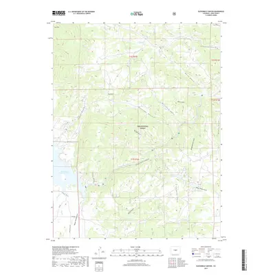
2019 Map of Elevenmile Canyon
USGS Topo · Published 2019About this map
The South Platte River carves its way through the dramatic landscape of Pike National Forest, defining the geography of the Elevenmile Canyon region. This 2019 survey captures the rugged drainage network surrounding the Elevenmile Canyon Reservoir and the Wagon Tongue Reservoir. The terrain is characterized by complex gulches like Messenger Gulch and Corduroy Gulch, which cut through the Puma Hills and descend from the heights of Stoll Mtn.
Find a feature on this map
37 named features on this map. Tap any name to fly to it.
Don’t see what you’re looking for? This feature index may not catch every label — zoom into the map to look around manually.
Map Details
Editions of this 2019 Elevenmile Canyon Map
This is the sole edition of this map. No revisions or reprints were ever made.
Other maps of this area

1893 · Platte Canyon
USGS Topo · 1:125,000

1894 · Pikes Peak
USGS Topo · 1:125,000

1901 · Pikes Peak
USGS Topo · 1:125,000

1953 · Denver
USGS Topo · 1:250,000

1954 · Pueblo
USGS Topo · 1:250,000

1956 · Tarryall
USGS Topo · 1:24,000

1956 · Hackett Mountain
USGS Topo · 1:24,000

1956 · Lake George
USGS Topo · 1:24,000

1956 · Elevenmile Canyon
USGS Topo · 1:24,000

1956 · Glentivar
USGS Topo · 1:24,000