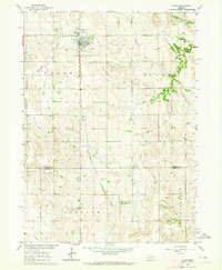
1963 Map of Elgin
USGS Topo · Published 1964About this map
Elgin serves as the primary hub of this 1963 landscape, situated at the intersection of local industry and agriculture in Antelope County. The town is anchored by the Chicago and North Western railroad line, which runs north-south through the terrain. To the south, the smaller settlement of Raeville appears near the border with Boone County, illustrating the sparse but organized settlement pattern of the Nebraska plains during the early 1960s.
Find a feature on this map
14 named features on this map. Tap any name to fly to it.
Don’t see what you’re looking for? This feature index may not catch every label — zoom into the map to look around manually.
Map Details
Editions of this 1963 Elgin Map
2 editions found
Other maps of this area

1955 · Broken Bow
USGS Topo · 1:250,000

1955 · Sioux City
USGS Topo · 1:250,000

1955 · Fremont
USGS Topo · 1:250,000

1955 · O'Neill
USGS Topo · 1:250,000

1956 · Broken Bow
USGS Topo · 1:250,000

1957 · Fremont
USGS Topo · 1:250,000

1958 · Sioux City
USGS Topo · 1:250,000

1958 · Fremont
USGS Topo · 1:250,000

1959 · O'Neill
USGS Topo · 1:250,000

1959 · Sioux City
USGS Topo · 1:250,000