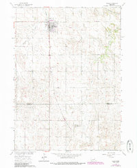
1963 Map of Elgin
USGS Topo · Published 1985About this map
The town of Elgin serves as the central hub for this portion of the Nebraska plains, positioned along the C & N W railway lines. To the south, the village of Raeville appears as a smaller outlying settlement, while the surrounding landscape is defined by the winding paths of Blacksnake Creek and Cedar Creek. Aerial photography from the 1960s, updated with 1980s revisions, reveals the transition of local infrastructure, notably marking an Old Railroad Grade that speaks to the shifting transportation needs of the agricultural community. Further evidence of local utility and transport is found at the Koinzan Landing Strip and a nearby Substation. The map also clearly delineates the Antelope Co Boone Co line, providing a precise record of the administrative and topographic character of the region during the mid-to-late 20th century.
Find a feature on this map
13 named features on this map. Tap any name to fly to it.
Don’t see what you’re looking for? This feature index may not catch every label — zoom into the map to look around manually.
Map Details
Editions of this 1963 Elgin Map
2 editions found
Other maps of this area

1955 · Broken Bow
USGS Topo · 1:250,000

1955 · Sioux City
USGS Topo · 1:250,000

1955 · Fremont
USGS Topo · 1:250,000

1955 · O'Neill
USGS Topo · 1:250,000

1956 · Broken Bow
USGS Topo · 1:250,000

1957 · Fremont
USGS Topo · 1:250,000

1958 · Sioux City
USGS Topo · 1:250,000

1958 · Fremont
USGS Topo · 1:250,000

1959 · O'Neill
USGS Topo · 1:250,000

1959 · Sioux City
USGS Topo · 1:250,000