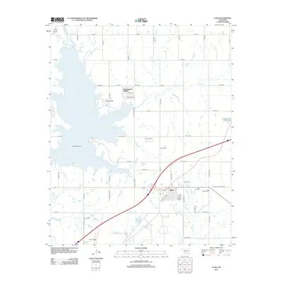
2012 Map of Elgin
USGS Topo · Published 2012About this map
Elgin serves as the primary hub for this Oklahoma landscape, situated at the crossroads of regional transit and rural development in the early 2010s. The town's grid is flanked by the Elgin Memorial Cem and Saint Anns Cem, while residential expansion appears near the shoreline of Lake Ellsworth at the Lake Ellsworth Addition and Cove Acres. The southwestern corner of the sheet is notably dominated by the Ft Sill National Cem, a site of significant local and national heritage.
Find a feature on this map
73 named features on this map. Tap any name to fly to it.
Don’t see what you’re looking for? This feature index may not catch every label — zoom into the map to look around manually.
Map Details
Editions of this 2012 Elgin Map
This is the sole edition of this map. No revisions or reprints were ever made.
Other maps of this area

1946 · Lawton
USGS Topo · 1:62,500

1949 · Arbuckle Hill
USGS Topo · 1:24,000

1949 · Cement
USGS Topo · 1:62,500

1949 · Elgin
USGS Topo · 1:24,000

1949 · Fort Sill
USGS Topo · 1:24,000

1949 · Nellie
USGS Topo · 1:62,500

1955 · Lawton
USGS Topo · 1:250,000

1956 · Sterling
USGS Topo · 1:24,000

1956 · Fletcher
USGS Topo · 1:24,000

1956 · Arbuckle Hill
USGS Topo · 1:24,000