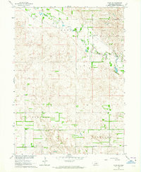
1963 Map of Elgin SW
USGS Topo · Published 1964About this map
Beaver Creek meanders across this rural section of Boone County, anchoring a landscape defined by the expansive townships of Oakland, Bonanza, and Ashland. The terrain is characterized by the intricate drainage patterns feeding into the creek, reflecting a mid-century agricultural environment where section lines and field boundaries are clearly demarcated. The map, developed as part of the Missouri River Basin program, illustrates the isolation and essential infrastructure of the Nebraska plains during the early 1960s.
Find a feature on this map
6 named features on this map. Tap any name to fly to it.
Don’t see what you’re looking for? This feature index may not catch every label — zoom into the map to look around manually.
Map Details
Editions of this 1963 Elgin SW Map
2 editions found
Other maps of this area

1954 · Spalding
USGS Topo · 1:24,000

1954 · Akron
USGS Topo · 1:24,000

1954 · Albion West
USGS Topo · 1:24,000

1955 · Broken Bow
USGS Topo · 1:250,000

1956 · Broken Bow
USGS Topo · 1:250,000

1960 · Spalding 2 NE
USGS Topo · 1:24,000

1960 · Spalding 2 SE
USGS Topo · 1:24,000

1963 · Petersburg
USGS Topo · 1:24,000

1963 · Elgin NW
USGS Topo · 1:24,000
1963 · Elgin
USGS Topo · 1:24,000