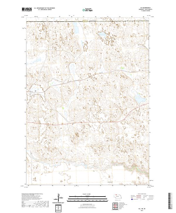
2021 Map of Eli
USGS Topo · Published 2021About this map
Cherry County grasslands meet the South Dakota border in this modern survey of the Nebraska Sandhills. The small settlement of Eli serves as a primary point of reference along the Cowboy Trail, a prominent east-west corridor across the northern plains. This landscape is defined by its subtle topography and internal drainage, where water bodies like Nelson Lake and the intermittent flows of Bear Creek gather in the depressions between sand dunes. The southern portion of the sheet transitions into the broad expanse of Connelly Flat, illustrating the unique geomorphology of this cattle-ranching region. Local access is maintained through a sparse network of rural routes, including Nelson Rd, which navigates the undulating terrain north toward the state line.
Find a feature on this map
13 named features on this map. Tap any name to fly to it.
Don’t see what you’re looking for? This feature index may not catch every label — zoom into the map to look around manually.
Map Details
Editions of this 2021 Eli Map
This is the sole edition of this map. No revisions or reprints were ever made.
Other maps of this area

1951 · Merriman
USGS Topo · 1:62,500

1952 · Eli
USGS Topo · 1:62,500

1955 · Martin
USGS Topo · 1:250,000

1957 · Valentine
USGS Topo · 1:250,000

1958 · Martin
USGS Topo · 1:250,000

1959 · Valentine
USGS Topo · 1:250,000

1981 · Phantom Lake
USGS Topo · 1:25,000

1981 · Scotchman Lake
USGS Topo · 1:25,000

1983 · Martin
USGS Topo · 1:100,000

1985 · Eli SE
USGS Topo · 1:24,000