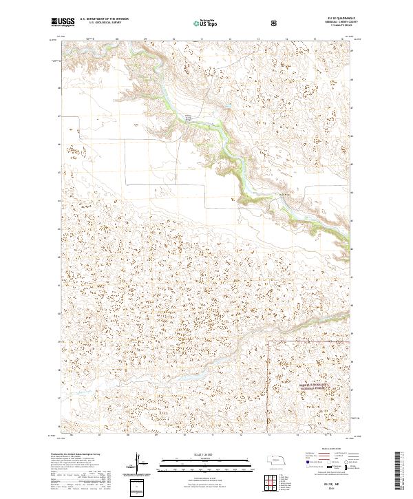
2021 Map of Eli SE
USGS Topo · Published 2021About this map
The Niobrara River carves a deep valley through the northern reaches of this Cherry County landscape, a stark contrast to the surrounding sandhills. This 2021 survey documents a relatively undeveloped section of the Nebraska interior where human infrastructure is limited to sparse crossings like the Boiling Spring Bridge and Mogle Bridge. The southern portion of the map is dominated by the northern fringes of the Samuel R McKelvie National Forest, characterized by vast grasslands and the winding course of Medicine Cr. The presence of Boiling Spring along the Niobrara suggests the unique hydrological intersections of the Ogallala Aquifer and the river valley, a vital resource for the ranching and natural ecology of this high plains region.
Find a feature on this map
12 named features on this map. Tap any name to fly to it.
Don’t see what you’re looking for? This feature index may not catch every label — zoom into the map to look around manually.
Map Details
Editions of this 2021 Eli SE Map
This is the sole edition of this map. No revisions or reprints were ever made.
Other maps of this area

1950 · Powderhorn Valley
USGS Topo · 1:62,500

1950 · Cody
USGS Topo · 1:62,500

1950 · Doughboy
USGS Topo · 1:62,500

1952 · Eli
USGS Topo · 1:62,500

1952 · Doughboy
USGS Topo · 1:62,500

1957 · Valentine
USGS Topo · 1:250,000

1959 · Valentine
USGS Topo · 1:250,000

1985 · Heath Valley
USGS Topo · 1:24,000

1985 · Eli SE
USGS Topo · 1:24,000
1985 · Cody East
USGS Topo · 1:24,000