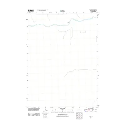
2011 Map of Eli SW
USGS Topo · Published 2011About this map
Niobrara River winds across the northern reaches of this Nebraska landscape, providing the primary geographical landmark in an otherwise open and sparse section of the Sandhills. The terrain is defined by a network of rural trails and service roads that navigate the subtle elevation changes of the river valley. A notable point of crossing is found at Garner Bridge, which serves as a vital infrastructure link for the remote ranches and grazing lands of the region. This 2011 survey illustrates the modern distribution of these rural pathways, showing how transportation routes remain tied to the river's path and the local topography. For those studying the recent history of land use in Cherry County, the map offers a clear view of how sparsely populated ranching country is organized around its limited water resources and established river crossings.
Find a feature on this map
2 named features on this map. Tap any name to fly to it.
Don’t see what you’re looking for? This feature index may not catch every label — zoom into the map to look around manually.
Map Details
Editions of this 2011 Eli SW Map
This is the sole edition of this map. No revisions or reprints were ever made.
Other maps of this area

1950 · Doughboy
USGS Topo · 1:62,500

1951 · Merriman
USGS Topo · 1:62,500

1951 · Merriman 4
USGS Topo · 1:62,500

1952 · Eli
USGS Topo · 1:62,500

1952 · Doughboy
USGS Topo · 1:62,500

1957 · Valentine
USGS Topo · 1:250,000

1959 · Valentine
USGS Topo · 1:250,000

1985 · Heath Valley
USGS Topo · 1:24,000

1985 · Eli SE
USGS Topo · 1:24,000
1985 · Eli
USGS Topo · 1:24,000