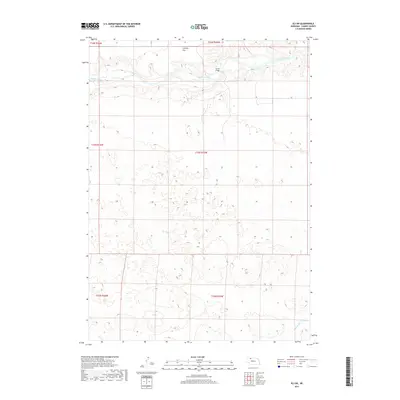
2017 Map of Eli SW
USGS Topo · Published 2017About this map
The Niobrara River carves a distinct northern boundary through this section of the Nebraska Sandhills, defining a landscape of narrow riparian corridors set against the expansive upland terrain. The river is the primary geographic anchor, punctuated by the Garner Bridge, which serves as a critical crossing point in an otherwise open and sparsely populated ranching environment. To the north, the plateau of Connely Flat rises above the valley floor, illustrating the abrupt elevation changes that characterize this portion of Cherry County. In the southeastern corner of the quadrangle, Medicine Cr provides a secondary drainage pattern, winding through the undulating hills. This 2017 survey reflects the enduring character of the High Plains, where water sources and established river crossings like those on the Niobrara remain the primary drivers of infrastructure and movement across the vast, sandy landscape.
Find a feature on this map
10 named features on this map. Tap any name to fly to it.
Don’t see what you’re looking for? This feature index may not catch every label — zoom into the map to look around manually.
Map Details
Editions of this 2017 Eli SW Map
This is the sole edition of this map. No revisions or reprints were ever made.
Other maps of this area

1950 · Doughboy
USGS Topo · 1:62,500

1951 · Merriman
USGS Topo · 1:62,500

1951 · Merriman 4
USGS Topo · 1:62,500

1952 · Eli
USGS Topo · 1:62,500

1952 · Doughboy
USGS Topo · 1:62,500

1957 · Valentine
USGS Topo · 1:250,000

1959 · Valentine
USGS Topo · 1:250,000

1985 · Heath Valley
USGS Topo · 1:24,000

1985 · Eli SE
USGS Topo · 1:24,000
1985 · Eli
USGS Topo · 1:24,000