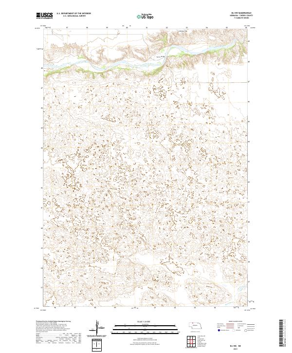
2021 Map of Eli SW
USGS Topo · Published 2021About this map
The Niobrara River winds across the northern reaches of this landscape, carving a distinct valley through the sandhills of northern Nebraska. This 2021 survey reveals a sparsely populated terrain characterized by undulating dunes and the wide, flat expanse of Connely Flat. In the northeast corner, Garner Bridge provides a rare crossing point over the river, a critical infrastructure element in a region defined by its wide-open cattle country and remote ranching heritage. To the south, the headwaters of Medicine Cr begin to take shape, draining the high ground toward the Republican River basin. This sheet captures the contemporary state of the Nebraska Sandhills, where the economy remains tied to the ancient hydrology of the Ogallala Aquifer and the seasonal flow of the Niobrara.
Find a feature on this map
11 named features on this map. Tap any name to fly to it.
Don’t see what you’re looking for? This feature index may not catch every label — zoom into the map to look around manually.
Map Details
Editions of this 2021 Eli SW Map
This is the sole edition of this map. No revisions or reprints were ever made.
Other maps of this area

1950 · Doughboy
USGS Topo · 1:62,500

1951 · Merriman
USGS Topo · 1:62,500

1951 · Merriman 4
USGS Topo · 1:62,500

1952 · Eli
USGS Topo · 1:62,500

1952 · Doughboy
USGS Topo · 1:62,500

1957 · Valentine
USGS Topo · 1:250,000

1959 · Valentine
USGS Topo · 1:250,000

1985 · Heath Valley
USGS Topo · 1:24,000

1985 · Eli SE
USGS Topo · 1:24,000
1985 · Eli
USGS Topo · 1:24,000