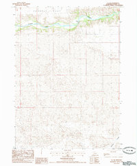
1985 Map of Eli SW
USGS Topo · Published 1985About this map
The Niobrara River carves a deep, winding valley across the northern reaches of this mid-1980s Cherry County landscape. Above the river’s northern bank, the terrain levels out into the broad expanse of Connely Flat, where the presence of an Irr Well indicates the agricultural development of these Nebraska tablelands. Crossing the river, Garner Bridge provides a vital transit point in an otherwise open and sparse rangeland. To the south, the topography transitions into the intricate, rolling patterns of the Sandhills, eventually descending toward the headwaters of Medicine Creek. This survey captures the isolated character of the Nebraska backcountry, where the placement of lone bridges and wells defines the footprint of human activity in a landscape dominated by the river's drainage.
Find a feature on this map
9 named features on this map. Tap any name to fly to it.
Don’t see what you’re looking for? This feature index may not catch every label — zoom into the map to look around manually.
Map Details
Editions of this 1985 Eli SW Map
This is the sole edition of this map. No revisions or reprints were ever made.
Other maps of this area

1950 · Doughboy
USGS Topo · 1:62,500

1951 · Merriman
USGS Topo · 1:62,500

1951 · Merriman 4
USGS Topo · 1:62,500

1952 · Eli
USGS Topo · 1:62,500

1952 · Doughboy
USGS Topo · 1:62,500

1957 · Valentine
USGS Topo · 1:250,000

1959 · Valentine
USGS Topo · 1:250,000

1985 · Heath Valley
USGS Topo · 1:24,000

1985 · Eli SE
USGS Topo · 1:24,000
1985 · Eli
USGS Topo · 1:24,000