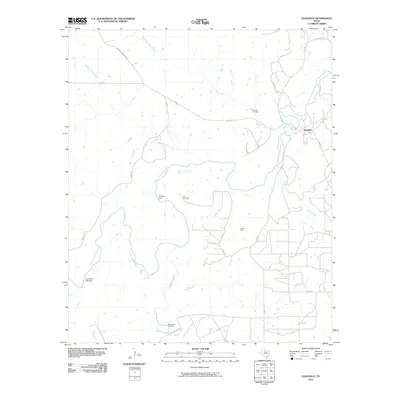
2010 Map of Eliasville
USGS Topo · Published 2010About this map
The Clear Fork Brazos River carves a winding path through this corner of Young County, anchoring the landscape near the small settlement of Eliasville. In the first decade of the 21st century, the area maintained its rural character, defined by a network of ranch roads and water management features such as Humble Dam and the A A Atkins Lake Dam. The industrial legacy of the region is evidenced by the Hill Oil Field, while several family-named burial grounds, including Donnell Cemetery, Hill Cemetery, and Yellow Fork Cemetery, offer valuable data points for genealogical research. Numerous tributaries like Bufford Creek, Wagon Timber Creek, and Gage Creek intersect the terrain, illustrating the complex drainage of the Brazos River basin in North Texas.
Find a feature on this map
29 named features on this map. Tap any name to fly to it.
Don’t see what you’re looking for? This feature index may not catch every label — zoom into the map to look around manually.
Map Details
Editions of this 2010 Eliasville Map
This is the sole edition of this map. No revisions or reprints were ever made.
Other maps of this area

1890 · Breckenridge
USGS Topo · 1:125,000

1925 · Graham 4-c
USGS Topo · 1:48,000

1925 · Breckenridge 1-b
USGS Topo · 1:48,000

1927 · Graham
USGS Topo · 1:62,500

1931 · Ivan
USGS Topo · 1:62,500

1954 · Abilene
USGS Topo · 1:250,000

1954 · Wichita Falls
USGS Topo · 1:250,000

1958 · Wichita Falls
USGS Topo · 1:250,000

1958 · Abilene
USGS Topo · 1:250,000

1958 · Breckenridge
USGS Topo · 1:24,000