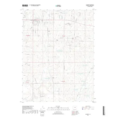
2019 Map of Elizabeth
USGS Topo · Published 2019About this map
Elizabeth serves as the primary hub in this portion of Elbert County, characterized by a transition from town streets to a landscape defined by significant water management and private aviation. The town's grid, featuring W Kiowa Ave and S Elbert St, quickly gives way to numerous flood control structures such as the Richard Warne Flood Retention Reservoir and the C G Cozart Erosion Control Reservoir Number 1. This pattern of erosion control and water retention is evident across the terrain, notably along the Kiowa Cr Watershed series. Local history is anchored at the Elizabeth Cem and the Kiowa Old Cem to the southeast. The area also highlights a unique cluster of private airfields, including Pine View Airport, Dietrichs Airport, and Circle 8 Ranch Airport, reflecting the region's reliance on small-scale aviation amidst the drainage basins of Running Cr and Little Dry Cr.
Find a feature on this map
92 named features on this map. Tap any name to fly to it.
Don’t see what you’re looking for? This feature index may not catch every label — zoom into the map to look around manually.
Map Details
Editions of this 2019 Elizabeth Map
This is the sole edition of this map. No revisions or reprints were ever made.
Other maps of this area

1894 · Castle Rock
USGS Topo · 1:125,000

1913 · Castle Rock
USGS Topo · 1:125,000

1939 · Elizabeth
USGS Topo · 1:62,500

1940 · Elbert
USGS Topo · 1:62,500

1944 · Elbert
USGS Topo · 1:62,500

1945 · Elizabeth
USGS Topo · 1:62,500

1953 · Denver
USGS Topo · 1:250,000

1954 · Cherry Valley School
USGS Topo · 1:24,000

1957 · Denver
USGS Topo · 1:250,000

1958 · Denver
USGS Topo · 1:250,000