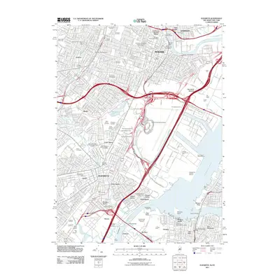
2011 Map of Elizabeth
USGS Topo · Published 2011About this map
Newark and Elizabeth form a dense urban and industrial corridor along the Arthur Kill and Newark Bay in this 2011 survey. The landscape is defined by massive transportation and maritime infrastructure, including the sprawling Newark International Airport, the Port Newark Terminal, and the Elizabeth Authority Piers. These facilities, alongside major rail nodes like Oak Island Junction, illustrate the region's role as a global logistics hub.
Find a feature on this map
83 named features on this map. Tap any name to fly to it.
Don’t see what you’re looking for? This feature index may not catch every label — zoom into the map to look around manually.
Map Details
Editions of this 2011 Elizabeth Map
This is the sole edition of this map. No revisions or reprints were ever made.
Other maps of this area

1888 · Plainfield
USGS Topo · 1:62,500

1888 · Morristown
USGS Topo · 1:62,500

1888 · Paterson
USGS Topo · 1:62,500

1892 · Paterson
USGS Topo · 1:62,500

1893 · Plainfield
USGS Topo · 1:62,500

1894 · Morristown
USGS Topo · 1:62,500

1898 · Morristown
USGS Topo · 1:62,500

1898 · Plainfield
USGS Topo · 1:62,500

1898 · Staten Island
USGS Topo · 1:62,500

1898 · Paterson
USGS Topo · 1:62,500