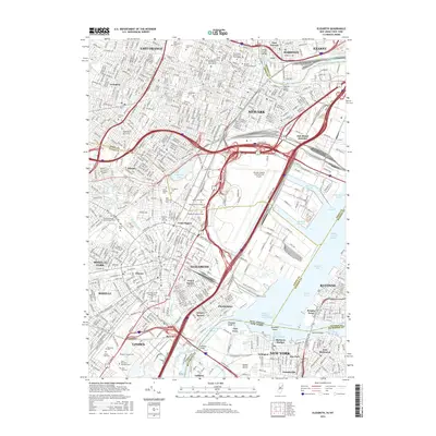
2016 Map of Elizabeth
USGS Topo · Published 2016About this map
The dense urban industrial corridor of northern New Jersey is captured here, centered on the complex transportation and maritime hub of Elizabeth and southern Newark. At the heart of the landscape lies the Newark Liberty International Airport, surrounded by a web of major thoroughfares including the New Jersey Tpke and the Garden State Parkway. The map reveals the intricate maritime geography of Newark Bay, where the Elizabeth Channel and Port Newark Channel serve the region's massive shipping needs.
Find a feature on this map
83 named features on this map. Tap any name to fly to it.
Don’t see what you’re looking for? This feature index may not catch every label — zoom into the map to look around manually.
Map Details
Editions of this 2016 Elizabeth Map
This is the sole edition of this map. No revisions or reprints were ever made.
Other maps of this area

1888 · Plainfield
USGS Topo · 1:62,500

1888 · Morristown
USGS Topo · 1:62,500

1888 · Paterson
USGS Topo · 1:62,500

1892 · Paterson
USGS Topo · 1:62,500

1893 · Plainfield
USGS Topo · 1:62,500

1894 · Morristown
USGS Topo · 1:62,500

1898 · Morristown
USGS Topo · 1:62,500

1898 · Plainfield
USGS Topo · 1:62,500

1898 · Staten Island
USGS Topo · 1:62,500

1898 · Paterson
USGS Topo · 1:62,500