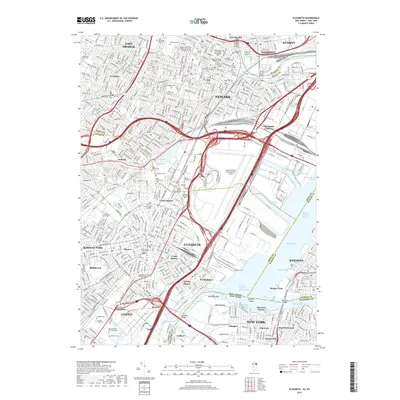
2019 Map of Elizabeth
USGS Topo · Published 2019About this map
Newark and Elizabeth form the dense urban core of this industrial landscape, where the heavy rail infrastructure of Conrail and the New Jersey Turnpike converge near Newark Liberty International Airport. The map highlights a massive network of transit and trade, centered on the deep-water access of Newark Bay and the specialized maritime facilities at Port Newark Channel and Elizabeth Channel. Educational institutions are prominent throughout the region, including Rutgers University - Newark Campus, New Jersey Institute of Technology, and Kean University.
Find a feature on this map
94 named features on this map. Tap any name to fly to it.
Don’t see what you’re looking for? This feature index may not catch every label — zoom into the map to look around manually.
Map Details
Editions of this 2019 Elizabeth Map
This is the sole edition of this map. No revisions or reprints were ever made.
Other maps of this area

1888 · Plainfield
USGS Topo · 1:62,500

1888 · Morristown
USGS Topo · 1:62,500

1888 · Paterson
USGS Topo · 1:62,500

1892 · Paterson
USGS Topo · 1:62,500

1893 · Plainfield
USGS Topo · 1:62,500

1894 · Morristown
USGS Topo · 1:62,500

1898 · Morristown
USGS Topo · 1:62,500

1898 · Plainfield
USGS Topo · 1:62,500

1898 · Staten Island
USGS Topo · 1:62,500

1898 · Paterson
USGS Topo · 1:62,500