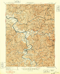
1926 Map of Elizabeth
USGS Topo · Published 1948About this map
The Hughes River winds through a dense network of ridges and rural settlements in the mid-1920s, anchoring a landscape defined by small-scale farming and the Baltimore and Ohio railroad. The county seat at Elizabeth serves as the primary hub along the Little Kanawha river, while smaller villages like Petroleum and Kanawha Station follow the rail lines and riverbanks. This era in West Virginia's history is reflected in the high density of neighborhood institutions, including the Mt Olive Church and a remarkable number of country schoolhouses.
Find a feature on this map
158 named features on this map. Tap any name to fly to it.
Don’t see what you’re looking for? This feature index may not catch every label — zoom into the map to look around manually.
Map Details
Editions of this 1926 Elizabeth Map
3 editions found

Other maps of this area

1902 · Parkersburg
USGS Topo · 1:62,500

1904 · Parkersburg
USGS Topo · 1:62,500

1904 · Marietta
USGS Topo · 1:62,500

1906 · Saint Marys
USGS Topo · 1:62,500

1906 · Elizabeth
USGS Topo · 1:62,500

1906 · Belleville
USGS Topo · 1:62,500

1907 · Harrisville
USGS Topo · 1:62,500

1907 · Arnoldsburg
USGS Topo · 1:62,500

1907 · Spencer
USGS Topo · 1:62,500

1907 · Ripley
USGS Topo · 1:62,500