
1926 Map of Elizabeth
USGS Topo · Published 1926About this map
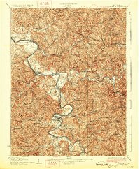
The Little Kanawha River snakes through the heart of Wirt and Wood counties in this mid-1920s survey, defining the economic life of Elizabeth and its surrounding hill country. This era finds the region deeply connected by the Baltimore and Ohio railroad, which follows the river's path through stops like Kanawha Station and Davisville. The landscape is exceptionally dense with rural community infrastructure, featuring a vast network of neighborhood schools such as Rising Sun School, Mountain Flower School, and Muddy Cut School, reflecting the high population density of these hollows before the mid-century transition to larger consolidated districts.
Find a feature on this map
102 named features on this map. Tap any name to fly to it.
Don’t see what you’re looking for? This feature index may not catch every label — zoom into the map to look around manually.
Map Details
Editions of this 1926 Elizabeth Map
3 editions found
Other maps of this area

1902 · Parkersburg
USGS Topo · 1:62,500

1904 · Parkersburg
USGS Topo · 1:62,500

1904 · Marietta
USGS Topo · 1:62,500

1906 · Saint Marys
USGS Topo · 1:62,500

1906 · Elizabeth
USGS Topo · 1:62,500

1906 · Belleville
USGS Topo · 1:62,500

1907 · Harrisville
USGS Topo · 1:62,500

1907 · Arnoldsburg
USGS Topo · 1:62,500

1907 · Spencer
USGS Topo · 1:62,500

1907 · Ripley
USGS Topo · 1:62,500