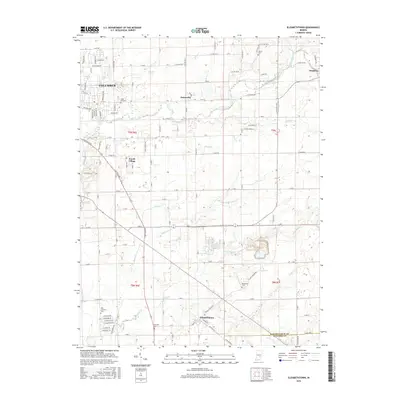
2016 Map of Elizabethtown
USGS Topo · Published 2016About this map
Elizabethtown and the eastern outskirts of Columbus anchor this survey of south-central Indiana’s agricultural landscape. The area is defined by a dense network of waterways, including the winding course of Clifty Creek and its tributaries like Otter Cr and Fishers Fork. These streams cut through a grid of rural roads and established settlements such as Petersville, Jewell Village, and Newbern. For those researching local families, the map identifies several smaller burial grounds, such as Sand Hill Cem and Donaldson Cem, which remain as quiet landmarks in the fields. The drainage patterns in the southern section, marked by Cooks Cr and Azalia Ditch, reflect the area's long-standing reliance on carefully managed water systems for its productive farmland. The southeastern corner also marks the transition from Bartholomew County into the Jennings County border, highlighting the administrative boundaries of the region.
Find a feature on this map
72 named features on this map. Tap any name to fly to it.
Don’t see what you’re looking for? This feature index may not catch every label — zoom into the map to look around manually.
Map Details
Editions of this 2016 Elizabethtown Map
This is the sole edition of this map. No revisions or reprints were ever made.
Other maps of this area

1942 · Columbus
USGS Topo · 1:125,000

1947 · Hope
USGS Topo · 1:24,000

1948 · Edinburg
USGS Topo · 1:24,000

1948 · Hope
USGS Topo · 1:24,000

1950 · Edinburg
USGS Topo · 1:62,500

1953 · Cincinnati
USGS Topo · 1:250,000

1957 · Cincinnati
USGS Topo · 1:250,000

1957 · Jonesville
USGS Topo · 1:24,000

1957 · Azalia
USGS Topo · 1:24,000

1957 · North Vernon
USGS Topo · 1:24,000