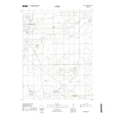
2019 Map of Elizabethtown
USGS Topo · Published 2019About this map
Columbus serves as a major anchor in the northwest, where residential developments like Jewell Village and various street grids such as Sawin Dr and Imperial Dr meet the agricultural lands of Bartholomew County. The landscape is defined by a dense network of waterways including Clifty Creek, Fishers Fork, and Little Sand Cr, which carve through the rural countryside. Small settlements like Petersville, Newbern, and Elizabethtown are scattered throughout, each maintaining a distinct identity through local landmarks. Genealogists will find significant value in the distribution of family and community burial grounds, such as Sand Hill Cem, Sharon Cem, and Donaldson Cem. The transition from the urban reach of Columbus to the structured fields of t9n r7e reveals a classic Midwestern pattern of town and country life, where older landmarks like the Railroad St corridor in Elizabethtown continue to orient the local geography.
Find a feature on this map
122 named features on this map. Tap any name to fly to it.
Don’t see what you’re looking for? This feature index may not catch every label — zoom into the map to look around manually.
Map Details
Editions of this 2019 Elizabethtown Map
This is the sole edition of this map. No revisions or reprints were ever made.
Other maps of this area

1942 · Columbus
USGS Topo · 1:125,000

1947 · Hope
USGS Topo · 1:24,000

1948 · Edinburg
USGS Topo · 1:24,000

1948 · Hope
USGS Topo · 1:24,000

1950 · Edinburg
USGS Topo · 1:62,500

1953 · Cincinnati
USGS Topo · 1:250,000

1957 · Cincinnati
USGS Topo · 1:250,000

1957 · Jonesville
USGS Topo · 1:24,000

1957 · Azalia
USGS Topo · 1:24,000

1957 · North Vernon
USGS Topo · 1:24,000