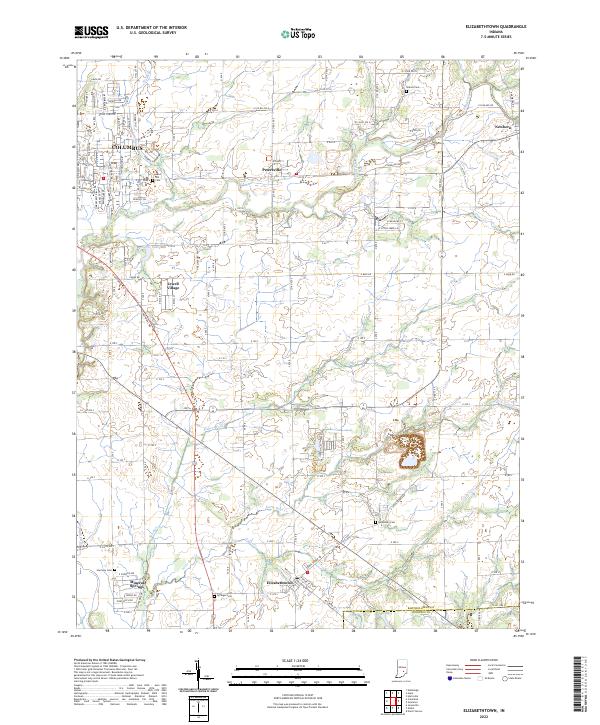
2022 Map of Elizabethtown
USGS Topo · Published 2022About this map
Elizabethtown and the eastern outskirts of Columbus define this portion of Bartholomew County, where the landscape transitions from the residential expansion of Jewell Village to the agricultural plains bisected by numerous waterways. The terrain is marked by the winding courses of Clifty Creek, Fishers Fork, and Little Sand Creek, which carve drainage patterns across the township lines of t9n r6e and t8n r7e. Small clusters of development at Petersville and Newbern provide focal points for the rural road network, which remains largely organized on a traditional grid.
Find a feature on this map
122 named features on this map. Tap any name to fly to it.
Don’t see what you’re looking for? This feature index may not catch every label — zoom into the map to look around manually.
Map Details
Editions of this 2022 Elizabethtown Map
This is the sole edition of this map. No revisions or reprints were ever made.
Other maps of this area

1942 · Columbus
USGS Topo · 1:125,000

1947 · Hope
USGS Topo · 1:24,000

1948 · Edinburg
USGS Topo · 1:24,000

1948 · Hope
USGS Topo · 1:24,000

1950 · Edinburg
USGS Topo · 1:62,500

1953 · Cincinnati
USGS Topo · 1:250,000

1957 · Cincinnati
USGS Topo · 1:250,000

1957 · Jonesville
USGS Topo · 1:24,000

1957 · Azalia
USGS Topo · 1:24,000

1957 · North Vernon
USGS Topo · 1:24,000