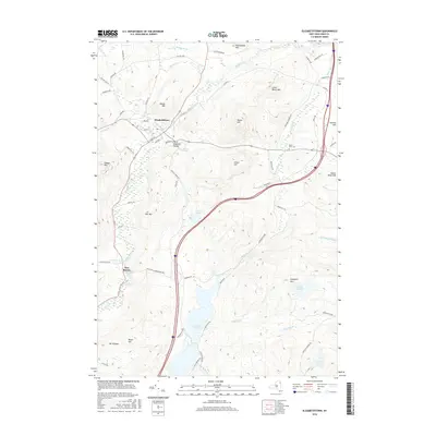
2016 Map of Elizabethtown
USGS Topo · Published 2016About this map
Elizabethtown and Pleasant Valley anchor this Essex County landscape, where the Boquet River and The Branch converge amid high peaks. The topography is defined by significant elevations including Raven Hill, Otis Mtn, and Mt Gilligan, illustrating the complex relief of the Adirondack Park. Settlement patterns follow the valley floors, with New Russia located to the south along the river corridor.
Find a feature on this map
70 named features on this map. Tap any name to fly to it.
Don’t see what you’re looking for? This feature index may not catch every label — zoom into the map to look around manually.
Map Details
Editions of this 2016 Elizabethtown Map
This is the sole edition of this map. No revisions or reprints were ever made.
Other maps of this area

1894 · Elizabethtown
USGS Topo · 1:62,500

1894 · Port Henry
USGS Topo · 1:62,500

1895 · Willsboro
USGS Topo · 1:62,500

1895 · Elizabethtown
USGS Topo · 1:62,500

1895 · Ausable
USGS Topo · 1:62,500

1898 · Port Henry
USGS Topo · 1:62,500

1901 · Elizabethtown
USGS Topo · 1:62,500

1903 · Ausable
USGS Topo · 1:62,500

1941 · Willsboro
USGS Topo · 1:62,500

1943 · Willsboro
USGS Topo · 1:62,500