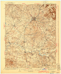
1938 Map of Elizabethtown
USGS Topo · Published 1940About this map
Elizabethtown serves as the central hub of this pre-war Kentucky landscape, where the Louisville and Nashville and Illinois Central railroads intersect. The region is characterized by a dense network of rural schoolhouses and churches, such as St Ignatius Ch and the Gilead Sch, reflecting the tightly-knit farming communities of Hardin and LaRue Counties. Along the winding Nolin River, small industrial and social landmarks like Star Mills, Eagle Mills, and the Childrens Home appear alongside family-named landmarks like Mathers Mill.
Find a feature on this map
69 named features on this map. Tap any name to fly to it.
Don’t see what you’re looking for? This feature index may not catch every label — zoom into the map to look around manually.
Map Details
Editions of this 1938 Elizabethtown Map
3 editions found
Other maps of this area

1925 · Cub Run
USGS Topo · 1:62,500

1932 · Big Clifty
USGS Topo · 1:62,500

1934 · Munfordville
USGS Topo · 1:48,000

1935 · Elizabethtown
USGS Topo · 1:48,000

1936 · Vine Grove
USGS Topo · 1:62,500

1937 · Munfordville
USGS Topo · 1:62,500

1938 · Elizabethtown
USGS Topo · 1:62,500

1941 · Ekron
USGS Topo · 1:62,500

1943 · Vine Grove
USGS Topo · 1:62,500

1946 · Colesburg
USGS Topo · 1:24,000