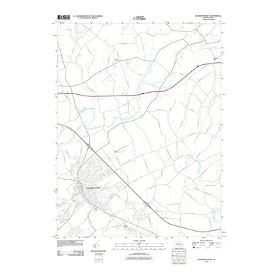
2010 Map of Elizabethtown
USGS Topo · Published 2010About this map
Elizabethtown and its surrounding agricultural landscape appear in high detail during the early 21st century. The town's grid and development are well-established near the confluence of Conoy Creek and several local runs. This survey documents a complex network of rural and residential roads, including family-named routes like Oberholtzer Rd, Witmer Rd, and Koser Rd, which hint at the region's deep genealogical roots and long-standing land tracts.
Find a feature on this map
77 named features on this map. Tap any name to fly to it.
Don’t see what you’re looking for? This feature index may not catch every label — zoom into the map to look around manually.
Map Details
Editions of this 2010 Elizabethtown Map
This is the sole edition of this map. No revisions or reprints were ever made.
Other maps of this area

1891 · Lebanon
USGS Topo · 1:62,500

1892 · Hummelstown
USGS Topo · 1:62,500

1893 · Lebanon
USGS Topo · 1:62,500

1899 · Lebanon
USGS Topo · 1:62,500

1902 · Lancaster
USGS Topo · 1:62,500

1904 · Lancaster
USGS Topo · 1:62,500

1908 · Middletown
USGS Topo · 1:62,500

1924 · Hummelstown
USGS Topo · 1:62,500

1943 · Lancaster
USGS Topo · 1:62,500

1943 · Lebanon
USGS Topo · 1:62,500
Featured Places
- Elizabethtown, PA
- Mount Joy Township, PA
- Lawn, South Londonderry Township
- Rapho Township, PA
- Upper Lawn, South Londonderry Township