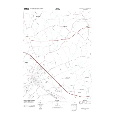
2013 Map of Elizabethtown
USGS Topo · Published 2013About this map
Conewago Cr and Little Conewago Cr wind through this part of Lancaster and Dauphin counties, shaping a landscape defined by longstanding agricultural properties and small rural settlements. Communities like Lawn, Colebrook, and Bellaire serve as focal points for the surrounding countryside, connected by a network of historic roads such as Bachmanville Rd and Old Hershey Rd. The presence of named agricultural sites like Chickies Creek Farm and Esbenshade Farms highlights the region's enduring farming legacy.
Find a feature on this map
177 named features on this map. Tap any name to fly to it.
Don’t see what you’re looking for? This feature index may not catch every label — zoom into the map to look around manually.
Map Details
Editions of this 2013 Elizabethtown Map
This is the sole edition of this map. No revisions or reprints were ever made.
Other maps of this area

1891 · Lebanon
USGS Topo · 1:62,500

1892 · Hummelstown
USGS Topo · 1:62,500

1893 · Lebanon
USGS Topo · 1:62,500

1899 · Lebanon
USGS Topo · 1:62,500

1902 · Lancaster
USGS Topo · 1:62,500

1904 · Lancaster
USGS Topo · 1:62,500

1908 · Middletown
USGS Topo · 1:62,500

1924 · Hummelstown
USGS Topo · 1:62,500
1943 · Lancaster
USGS Topo · 1:62,500
1943 · Lebanon
USGS Topo · 1:62,500
Featured Places
- Elizabethtown, PA
- Mount Joy Township, PA
- Lawn, South Londonderry Township
- Rapho Township, PA
- Upper Lawn, South Londonderry Township