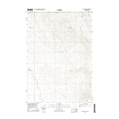
2015 Map of Elk Basin NW
USGS Topo · Published 2015About this map
Elk Basin defines the northeastern corner of this 2015 survey, where the border of Wyoming meets Montana in a region defined by dramatic topographic relief and energy infrastructure. The landscape is characterized by deep drainage systems and high plateaus, notably the prominent Polecat Bench in the southeast. Water follows the natural contours of the land through Silver Tip Cr and the winding path of Big Sand Coulee in the west. A network of rural routes, including Silvertip Rd and Cr-1ng, provides access through the townships of t58n r101w, t58n r100w, and t57n r100w. This modern topographic study reveals the persistent grid of the Public Land Survey System overlaid upon the irregular, eroded terrain typical of the Bighorn Basin’s northern reaches.
Find a feature on this map
12 named features on this map. Tap any name to fly to it.
Don’t see what you’re looking for? This feature index may not catch every label — zoom into the map to look around manually.
Map Details
Editions of this 2015 Elk Basin NW Map
This is the sole edition of this map. No revisions or reprints were ever made.
Other maps of this area

1944 · Red Lodge
USGS Topo · 1:62,500

1950 · Clark
USGS Topo · 1:62,500

1954 · Billings
USGS Topo · 1:250,000

1955 · Cody
USGS Topo · 1:250,000

1957 · Billings
USGS Topo · 1:250,000

1958 · Billings
USGS Topo · 1:250,000

1958 · Cody
USGS Topo · 1:250,000

1962 · Cody
USGS Topo · 1:250,000

1966 · Elk Basin SW
USGS Topo · 1:24,000

1966 · Elk Basin
USGS Topo · 1:24,000