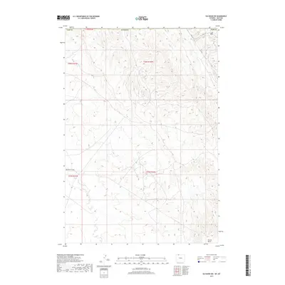
2017 Map of Elk Basin NW
USGS Topo · Published 2017About this map
Elk Basin sits at the northern edge of Park County, where the high desert terrain of the Bighorn Basin meets the Montana border. This landscape is defined by the significant geological depressions and landforms that have long influenced regional movement and industry, most notably the broad plateau of Polecat Bench in the southeast. The drainage of Silver Tip Creek carves through the basin to the north, while the winding course of Big Sand Coulee cuts across the western portion of the quadrangle. These natural features dictated the early transportation routes, including Rd 1 N G, which provides access into the heart of the basin's complex topography. The map illustrates the stark physical transition between the elevated bench lands and the deep coulees that characterize this corner of northern Wyoming.
Find a feature on this map
13 named features on this map. Tap any name to fly to it.
Don’t see what you’re looking for? This feature index may not catch every label — zoom into the map to look around manually.
Map Details
Editions of this 2017 Elk Basin NW Map
This is the sole edition of this map. No revisions or reprints were ever made.
Other maps of this area

1944 · Red Lodge
USGS Topo · 1:62,500

1950 · Clark
USGS Topo · 1:62,500

1954 · Billings
USGS Topo · 1:250,000

1955 · Cody
USGS Topo · 1:250,000

1957 · Billings
USGS Topo · 1:250,000

1958 · Billings
USGS Topo · 1:250,000

1958 · Cody
USGS Topo · 1:250,000

1962 · Cody
USGS Topo · 1:250,000

1966 · Elk Basin SW
USGS Topo · 1:24,000

1966 · Elk Basin
USGS Topo · 1:24,000