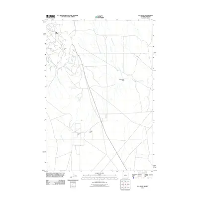
2011 Map of Elk Basin
USGS Topo · Published 2011About this map
Elk Basin defines this high-desert industrial landscape along the Wyoming-Montana border, where the extraction of natural resources has shaped the ground for over a century. The intricate network of roads and pipelines is anchored by the massive Elk Basin Oil Field in the north and the South Elk Basin Oil Field further south. These fields represent a significant piece of regional energy history, supported by local landmarks like the Silvertip Mine and Two Dot Mine. Drainage patterns across the arid terrain are dictated by seasonal watercourses such as Silver Tip Creek, Cottonwood Creek, and the broad Cottonwood Draw. The map meticulously details the infrastructure required for these remote operations, from the primary access of Long Draw Rd to the smaller service routes like 1ng Rd and 100 Rd, providing a clear view of the basin’s industrial footprint during the early 21st century.
Find a feature on this map
12 named features on this map. Tap any name to fly to it.
Don’t see what you’re looking for? This feature index may not catch every label — zoom into the map to look around manually.
Map Details
Editions of this 2011 Elk Basin Map
This is the sole edition of this map. No revisions or reprints were ever made.
Other maps of this area

1954 · Billings
USGS Topo · 1:250,000

1955 · Cody
USGS Topo · 1:250,000

1957 · Billings
USGS Topo · 1:250,000

1958 · Billings
USGS Topo · 1:250,000

1958 · Cody
USGS Topo · 1:250,000

1962 · Cody
USGS Topo · 1:250,000

1966 · Elk Basin SW
USGS Topo · 1:24,000

1966 · Garland
USGS Topo · 1:24,000

1966 · Elk Basin
USGS Topo · 1:24,000

1966 · Elk Basin NW
USGS Topo · 1:24,000