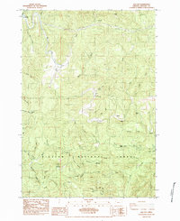
1984 Map of Elk City
USGS Topo · Published 1984About this map
Big Elk Creek meanders through this landscape in the Oregon Coast Range, anchoring a territory defined by timberlands and isolated settlements. In the northwest corner, Elk City sits at the confluence of several small drainages, while the small community of Salado is tucked further south along the creek valley. This 1984 survey, produced as a provisional map, highlights the complex network of ridges and watercourses that shaped local movement, from Divide Mtn in the west to the prominent Baber Butte in the north.
Find a feature on this map
32 named features on this map. Tap any name to fly to it.
Don’t see what you’re looking for? This feature index may not catch every label — zoom into the map to look around manually.
Map Details
Editions of this 1984 Elk City Map
This is the sole edition of this map. No revisions or reprints were ever made.
Other maps of this area

1939 · Marys Peak
USGS Topo · 1:62,500

1942 · Marys Peak
USGS Topo · 1:62,500

1942 · Alsea
USGS Topo · 1:62,500

1942 · Tidewater
USGS Topo · 1:62,500

1942 · Toledo
USGS Topo · 1:62,500

1953 · Salem
USGS Topo · 1:250,000

1954 · Salem
USGS Topo · 1:250,000

1956 · Alsea
USGS Topo · 1:62,500

1956 · Tidewater
USGS Topo · 1:62,500

1957 · Marys Peak
USGS Topo · 1:62,500