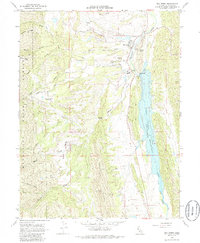
1968 Map of Elk Creek
USGS Topo · Published 1985About this map
Elk Creek serves as the focal point of this late 1960s study, situated at the edge of the Mendocino National Forest where the hills meet the water. The landscape is defined by the significant engineering of the Stony Gorge Dam, which impounds the Stony Gorge Reservoir along the eastern edge of the quadrangle. Local industry and infrastructure are evident through the Ivory Mill and its associated Ivory Mill Road, along with a Fire Control Station and a High Sch serving the small community.
Find a feature on this map
34 named features on this map. Tap any name to fly to it.
Don’t see what you’re looking for? This feature index may not catch every label — zoom into the map to look around manually.
Map Details
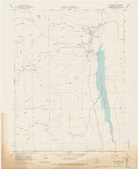
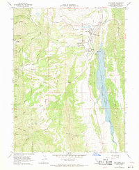
Editions of this 1968 Elk Creek Map
3 editions found
Other maps of this area

1919 · Fruto
USGS Topo · 1:62,500

1919 · Elk Creek
USGS Topo · 1:62,500

1943 · Lodoga
USGS Topo · 1:62,500

1944 · Fruto
USGS Topo · 1:62,500

1948 · Elk Creek
USGS Topo · 1:62,500

1951 · Stonyford
USGS Topo · 1:62,500

1957 · Elk Creek
USGS Topo · 1:62,500

1957 · Ukiah
USGS Topo · 1:250,000
1958 · Fruto
USGS Topo · 1:62,500

1960 · Ukiah
USGS Topo · 1:250,000