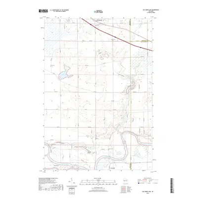
2018 Map of Elk Creek Lake
USGS Topo · Published 2018About this map
Chippewa River frontage and the low-lying Chippewa Bottoms anchor the southern reaches of this landscape where Dunn Co, Eau Claire Co, and Chippewa Co meet. The terrain transitions from the wide river valley and Brush Island to the higher elevations surrounding the village of Elk Mound in the north. This area is notably dense with small rural burial grounds, including Saint Joseph Cem, Evergreen Cem, and Waneka Cem, providing significant touchpoints for genealogical research. The local hydrology is defined by the winding course of Elk Cr and Old Elk Lake, which sits tucked between local routes like Co Rd E. In the south, the settlement of Caryville is positioned near the riverbanks, while smaller water bodies like Sneen Lake and Powell Lake dot the wetlands and agricultural fields that characterize this portion of Western Wisconsin.
Find a feature on this map
75 named features on this map. Tap any name to fly to it.
Don’t see what you’re looking for? This feature index may not catch every label — zoom into the map to look around manually.
Map Details
Editions of this 2018 Elk Creek Lake Map
This is the sole edition of this map. No revisions or reprints were ever made.
Other maps of this area

1929 · Durand
USGS Topo · 1:62,500

1932 · Durand
USGS Topo · 1:62,500

1932 · Mondovi
USGS Topo · 1:62,500

1934 · Elk Mound
USGS Topo · 1:62,500

1936 · Elk Mound
USGS Topo · 1:62,500

1940 · Menomonie
USGS Topo · 1:62,500

1942 · Menomonie
USGS Topo · 1:62,500

1953 · Eau Claire
USGS Topo · 1:250,000

1958 · Eau Claire
USGS Topo · 1:250,000

1964 · Eau Claire
USGS Topo · 1:250,000