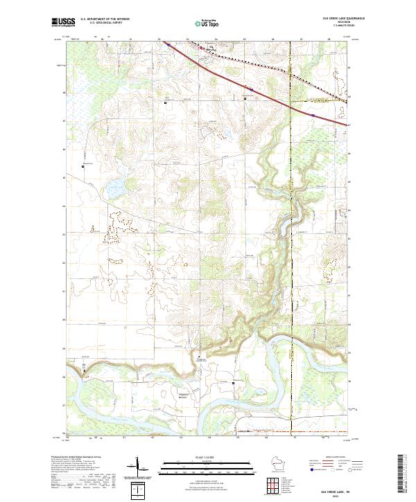
2022 Map of Elk Creek Lake
USGS Topo · Published 2022About this map
Caryville and the meandering Chippewa River anchor the southern portion of this landscape, where the wide floodplains of the Chippewa Bottoms give way to a network of rural roads and family-named cemeteries. The terrain rises significantly toward the north, reaching a high point at the prominent Elk Mound, which serves as a natural landmark overlooking the intersection of three counties. Scattered across the agricultural highlands are numerous burial grounds of genealogical significance, including Saint Joseph Cem, Evergreen Cem, and the Springbrook Lutheran Cem. Hydrological features such as Old Elk Lake and Powell Lake provide distinct breaks in the rolling topography, while the Chippewa River State Trl follows the southern riverbank, repurposing a former transport corridor for modern use.
Find a feature on this map
53 named features on this map. Tap any name to fly to it.
Don’t see what you’re looking for? This feature index may not catch every label — zoom into the map to look around manually.
Map Details
Editions of this 2022 Elk Creek Lake Map
This is the sole edition of this map. No revisions or reprints were ever made.
Other maps of this area

1929 · Durand
USGS Topo · 1:62,500

1932 · Durand
USGS Topo · 1:62,500

1932 · Mondovi
USGS Topo · 1:62,500

1934 · Elk Mound
USGS Topo · 1:62,500

1936 · Elk Mound
USGS Topo · 1:62,500

1940 · Menomonie
USGS Topo · 1:62,500

1942 · Menomonie
USGS Topo · 1:62,500

1953 · Eau Claire
USGS Topo · 1:250,000

1958 · Eau Claire
USGS Topo · 1:250,000

1964 · Eau Claire
USGS Topo · 1:250,000