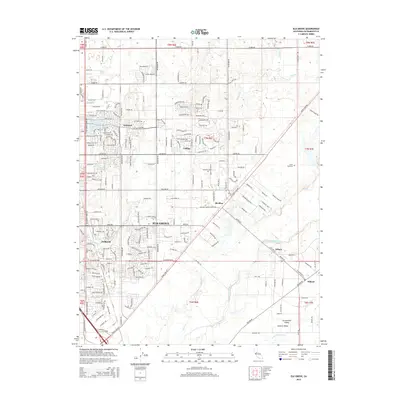
2015 Map of Elk Grove
USGS Topo · Published 2015About this map
The Sacramento Valley floor transitions into the residential and agricultural corridors of Elk Grove in the mid-2010s. This survey records a landscape shaped by a complex network of waterways, including the Cosumnes River and its tributaries like Deer Cr and Laguna Cr, which delineate the terrain between the central city and rural outposts like Wilton. The street grid, anchored by major thoroughfares such as Elk Grove Blvd and Grant Line Rd, shows the expansion of neighborhoods like Fallbrook and Vineyard alongside long-standing local landmarks like the Union Cemetery. Away from the urban core, smaller settlements like Sheldon, Coffing, and Dillard maintain their identities within the Central Valley landscape, offering a detailed look at the interface between modern development and traditional agricultural lands.
Find a feature on this map
34 named features on this map. Tap any name to fly to it.
Don’t see what you’re looking for? This feature index may not catch every label — zoom into the map to look around manually.
Map Details
Editions of this 2015 Elk Grove Map
This is the sole edition of this map. No revisions or reprints were ever made.
Other maps of this area

1891 · Sacramento
USGS Topo · 1:125,000

1892 · Sacramento
USGS Topo · 1:125,000

1893 · Sacramento
USGS Topo · 1:125,000

1894 · Lodi
USGS Topo · 1:125,000

1902 · Fairoaks
USGS Topo · 1:62,500

1908 · Buffalo Creek
USGS Topo · 1:31,680

1909 · Elk Grove
USGS Topo · 1:31,680

1909 · Clay
USGS Topo · 1:31,680

1909 · Cosumnes
USGS Topo · 1:31,680

1909 · Florin
USGS Topo · 1:31,680