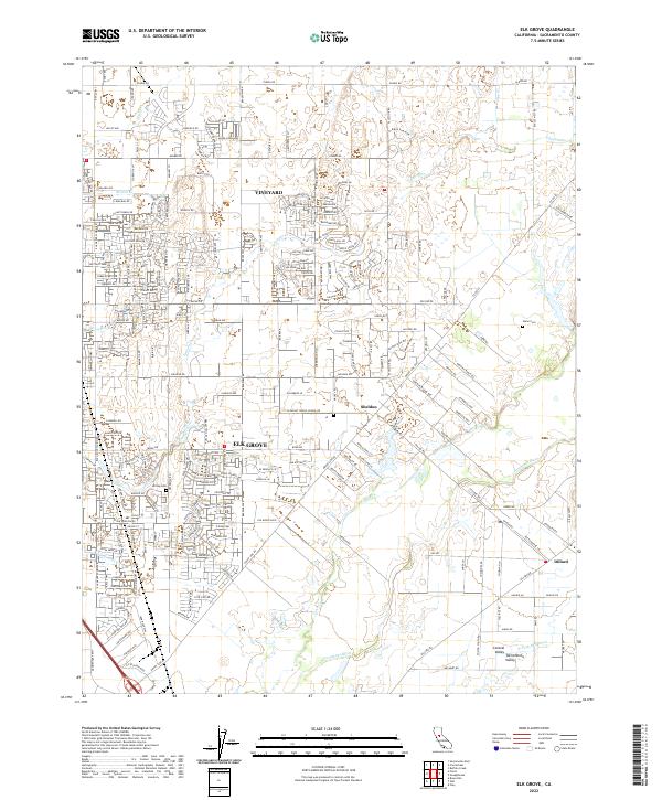
2022 Map of Elk Grove
USGS Topo · Published 2022About this map
Elk Grove serves as the central hub of this Sacramento Valley landscape, where suburban growth meets the expansive drainages of the Cosumnes River watershed. The map details a transition from the dense residential networks of Vineyard and western Elk Grove to the more open, rural parcels near Sheldon and Dillard. The presence of the Union Pacific Railroad corridor running north-south through the city center underscores the historical transport backbone that helped establish this region as an agricultural powerhouse.
Find a feature on this map
233 named features on this map. Tap any name to fly to it.
Don’t see what you’re looking for? This feature index may not catch every label — zoom into the map to look around manually.
Map Details
Editions of this 2022 Elk Grove Map
This is the sole edition of this map. No revisions or reprints were ever made.
Other maps of this area

1891 · Sacramento
USGS Topo · 1:125,000

1892 · Sacramento
USGS Topo · 1:125,000

1893 · Sacramento
USGS Topo · 1:125,000

1894 · Lodi
USGS Topo · 1:125,000

1902 · Fairoaks
USGS Topo · 1:62,500

1908 · Buffalo Creek
USGS Topo · 1:31,680

1909 · Elk Grove
USGS Topo · 1:31,680

1909 · Clay
USGS Topo · 1:31,680

1909 · Cosumnes
USGS Topo · 1:31,680

1909 · Florin
USGS Topo · 1:31,680