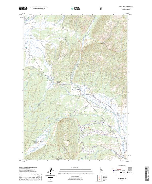
2024 Map of Elk Meadow
USGS Topo · Published 2024About this map
Challis National Forest and the peaks of the Sawtooth Range dominate this high-elevation Idaho landscape, where the settlement of Cape Horn sits at the junction of Marsh Creek and Kelly Creek. The map details a complex network of seasonal trails and backcountry routes, including the Shooting Star Ski Trl and Larkspur Trail Ski Trl, reflecting the area's modern role as a recreation hub. A distinctive geological passage at Trap Creek Narrows funnels the waters of Trap Creek toward its confluence with Valley Creek. At the foot of Elk Mtn, the wide expanse of Elk Meadow provides a break in the timbered slopes. Aviation history in this remote terrain is marked by the Silva Ranch Airport in the southeastern quadrant, while the presence of Hidden Lake tucked into the higher elevations illustrates the glacial character of the surrounding mountains.
Find a feature on this map
65 named features on this map. Tap any name to fly to it.
Don’t see what you’re looking for? This feature index may not catch every label — zoom into the map to look around manually.
Map Details
Editions of this 2024 Elk Meadow Map
This is the sole edition of this map. No revisions or reprints were ever made.
Other maps of this area

1891 · Bear Valley
USGS Topo · 1:125,000

1893 · Bear Valley
USGS Topo · 1:125,000

1919 · Custer
USGS Topo · 1:125,000

1922 · Custer
USGS Topo · 1:125,000

1957 · Challis
USGS Topo · 1:250,000

1960 · Challis
USGS Topo · 1:250,000

1963 · Challis
USGS Topo · 1:250,000

1963 · Stanley
USGS Topo · 1:24,000

1963 · Basin Butte
USGS Topo · 1:24,000
1964 · Knapp Lakes
USGS Topo · 1:24,000