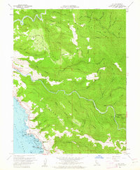
1960 Map of Elk
USGS Topo · Published 1962About this map
Elk, Greenwood, and Brown anchor this coastal landscape where the steep ridges of the Mendocino shoreline meet the Pacific. The terrain is defined by massive parallel formations including Albion Ridge, Navarro Ridge, and Greenwood Ridge, which dictated the early movement of goods and people between the coast and the inland forests. Along the Navarro River, a Gaging Station and the Airstrip indicate 20th-century utility, while the remote Dimmick Memorial Grove State Park preserves the timbered character of the North Fork.
Find a feature on this map
65 named features on this map. Tap any name to fly to it.
Don’t see what you’re looking for? This feature index may not catch every label — zoom into the map to look around manually.
Map Details
Editions of this 1960 Elk Map
3 editions found
Other maps of this area

1920 · Glenblair
USGS Topo · 1:62,500

1920 · Fort Bragg
USGS Topo · 1:62,500

1943 · Glenblair
USGS Topo · 1:62,500

1943 · Fort Bragg
USGS Topo · 1:62,500

1943 · Albion
USGS Topo · 1:62,500

1943 · Navarro
USGS Topo · 1:62,500

1944 · Saddle Point
USGS Topo · 1:62,500

1957 · Ukiah
USGS Topo · 1:250,000

1960 · Ukiah
USGS Topo · 1:250,000
1960 · Albion
USGS Topo · 1:24,000