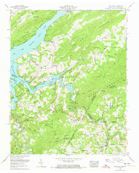
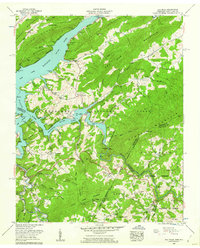
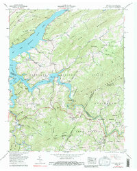
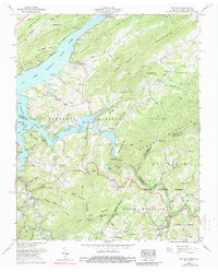
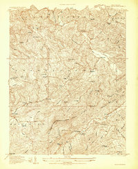
1959 Map of Elk Mills
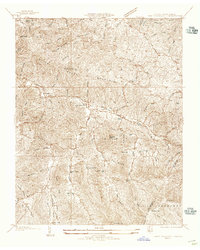
USGS Topo · Published 1974About this map
Watauga Lake dominates this mountain landscape, its convoluted shoreline reaching into the deep hollows of the Cherokee National Forest. Revised by the Tennessee Valley Authority in the late 1950s, the map illustrates the rugged geography of the Tennessee-North Carolina border where the Elk River and Watauga River converge. Settlement patterns follow the winding valley floors, with small communities like Elk Mills and Buntontown clustered near the water. Higher elevations remain dominated by timber and conservation, marked by the Buck Ridge Lookout Tower and various gaps like Colorado Gap. Evidence of local industry and rural life appears in the Strip mine located along Dry Run, and the numerous family cemeteries such as Proffitt Cem and Grindstaff Cem that dot the hillsides, providing a detailed record of the area's genealogical footprint before further modern development.
Find a feature on this map
90 named features on this map. Tap any name to fly to it.
Don’t see what you’re looking for? This feature index may not catch every label — zoom into the map to look around manually.
Map Details
Editions of this 1959 Elk Mills Map
4 editions found
Other maps of this area

1891 · Roan Mountain
USGS Topo · 1:125,000

1893 · Cranberry
USGS Topo · 1:125,000

1894 · Roan Mountain
USGS Topo · 1:125,000

1895 · Cranberry
USGS Topo · 1:125,000

1899 · Cranberry
USGS Topo · 1:125,000

1902 · Cranberry
USGS Topo · 1:125,000

1904 · Roan Mountain
USGS Topo · 1:125,000
1934 · Valle Crucis
USGS Topo · 1:24,000
1934 · White Rocks Mtn
USGS Topo · 1:24,000

1934 · Elk Park
USGS Topo · 1:24,000