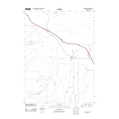
2012 Map of Elk Mountain
USGS Topo · Published 2012About this map
Elk Mountain and its surrounding ranchlands are the focal point of this Carbon County survey, situated where the Medicine Bow River winds through the high plains. The map details a landscape defined by the intersection of early pioneer infrastructure and modern transportation, featuring the historic Old Government Trl and the Elk Mountain Cem. A network of irrigation works, including Alpha Ditch and Tableland Ditch, underscores the importance of water management in this arid region, supporting numerous family operations such as the Garretson Ranch, Boles Ranch, and McKee Ranch. To the north, the Saddleback Hills and the Rattlesnake Pass Rd corridor trace the movement of travel across the terrain, while the local streets of the town of Elk Mountain, including Main St, provide a record of the community's layout.
Find a feature on this map
30 named features on this map. Tap any name to fly to it.
Don’t see what you’re looking for? This feature index may not catch every label — zoom into the map to look around manually.
Map Details
Editions of this 2012 Elk Mountain Map
This is the sole edition of this map. No revisions or reprints were ever made.
Other maps of this area

1893 · Fort Steele
USGS Topo · 1:125,000

1914 · Hanna
USGS Topo · 1:62,500

1914 · Saddleback Hills
USGS Topo · 1:62,500

1921 · Saddleback Hills
USGS Topo · 1:62,500

1954 · Rawlins
USGS Topo · 1:250,000

1955 · Elk Mountain
USGS Topo · 1:24,000

1955 · Elk Mountain SW
USGS Topo · 1:24,000

1955 · Rattlesnake Pass
USGS Topo · 1:24,000

1955 · Coad Mountain
USGS Topo · 1:24,000

1958 · Rawlins
USGS Topo · 1:250,000