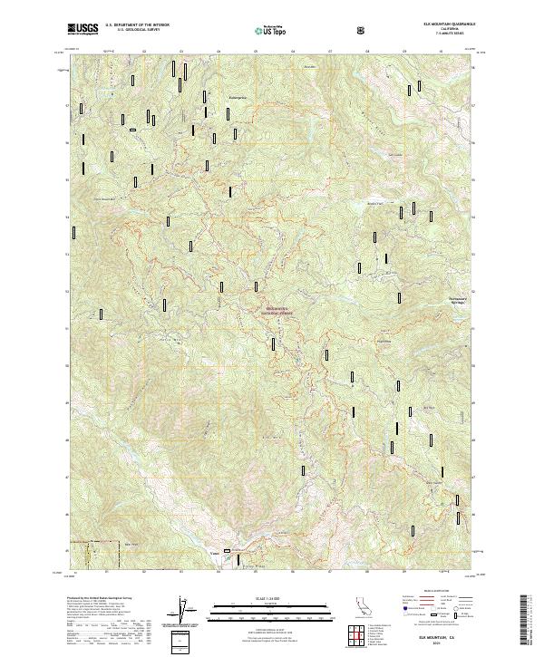
2021 Map of Elk Mountain
USGS Topo · Published 2021About this map
Mendocino National Forest encompasses this high-altitude landscape in the northern Coast Ranges, where steep ridges and deep canyons define the border between Mendocino and Lake counties. The 2021 topography highlights a complex network of forest trails and access roads, such as the Penny Pines Access Trl and Bacon Camp Trl, which navigate the slopes of major summits like Horse Mtn and Elk Mtn. Historically significant points include the settlement of Enterprise in the north and Parramore Springs to the east, reflecting the area's legacy of remote mountain habitation and natural spring sites. The drainage patterns of Rice Fork and W Fork Middle Cr illustrate the watershed's role in the regional hydrology. This modern survey details the transition from high peaks like Bear Peak to specialized terrain features like Salt Glade and Bevans Flat.
Find a feature on this map
86 named features on this map. Tap any name to fly to it.
Don’t see what you’re looking for? This feature index may not catch every label — zoom into the map to look around manually.
Map Details
Editions of this 2021 Elk Mountain Map
This is the sole edition of this map. No revisions or reprints were ever made.
Other maps of this area

1920 · Ukiah
USGS Topo · 1:62,500

1922 · Hullville
USGS Topo · 1:62,500

1938 · Lakeport
USGS Topo · 1:62,500

1943 · Pomo
USGS Topo · 1:62,500

1944 · Ukiah
USGS Topo · 1:62,500

1951 · Lake Pillsbury
USGS Topo · 1:62,500

1951 · Lakeport
USGS Topo · 1:62,500

1957 · Ukiah
USGS Topo · 1:250,000

1958 · Cow Mountain
USGS Topo · 1:24,000
1958 · Ukiah
USGS Topo · 1:62,500