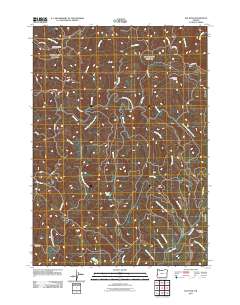
2011 Map of Elk Peak
USGS Topo · Published 2011About this map
Elk Peak and Dear Mountain anchor this drainage-heavy landscape in the Coast Range, where the complex headwaters of several major river systems converge. The terrain is defined by the winding course of the West Fork Millicoma River, which is fed by numerous named tributaries including Joes Creek, Otter Creek, and Panther Creek. The network of forestry roads, such as Umpcoos Rd and various numbered routes like 2000 Rd, suggests a landscape shaped by the timber industry and active land management. Notable landmarks for navigation and local history include the Loon Lake Lookout situated on a high ridge and the secluded Gould Lake. The southern portion of the map is marked by Stulls Falls on the West Fork Millicoma, illustrating the steep elevation changes that characterize these western Oregon watersheds.
Find a feature on this map
44 named features on this map. Tap any name to fly to it.
Don’t see what you’re looking for? This feature index may not catch every label — zoom into the map to look around manually.
Map Details
Editions of this 2011 Elk Peak Map
This is the sole edition of this map. No revisions or reprints were ever made.
Other maps of this area

1896 · Coos Bay
USGS Topo · 1:125,000

1898 · Coos Bay
USGS Topo · 1:125,000

1900 · Coos Bay
USGS Topo · 1:125,000

1923 · Reedsport
USGS Topo · 1:62,500

1928 · Sitkum
USGS Topo · 1:125,000

1942 · Reedsport
USGS Topo · 1:62,500

1942 · Coos Bay
USGS Topo · 1:62,500

1945 · Coos Bay
USGS Topo · 1:62,500

1954 · Coos Bay
USGS Topo · 1:250,000

1955 · Scottsburg
USGS Topo · 1:62,500