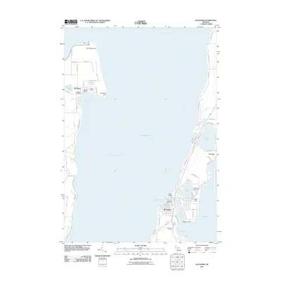
2011 Map of Elk Rapids
USGS Topo · Published 2011About this map
The Old Mission peninsula and the eastern shore of East Arm Grand Traverse Bay are the central focus of this 2011 coastal study. On the western landmass, the historic Old Mission Post Office and Lakeside Cemetery anchor a landscape defined by cherry orchards and vineyard terrain, culminating at Old Mission Point where the Old Mission Light stands. Across the water, the village of Elk Rapids serves as a critical maritime junction between Lake Michigan and the inland chain of lakes, specifically Elk Lake. The map reveals a dense network of seasonal and residential developments along the shoreline, particularly around Bass Lake and the Edward C Grace Memorial Harbor. From the quiet northern tip at Leffingwell Point to the community hubs at Kewadin, the geography reflects a region deeply shaped by its relationship to the bay and the preservation of its coastal heritage.
Find a feature on this map
65 named features on this map. Tap any name to fly to it.
Don’t see what you’re looking for? This feature index may not catch every label — zoom into the map to look around manually.
Map Details
Editions of this 2011 Elk Rapids Map
This is the sole edition of this map. No revisions or reprints were ever made.
Other maps of this area

1954 · Central Lake
USGS Topo · 1:62,500

1954 · Traverse City
USGS Topo · 1:250,000

1955 · Cheboygan
USGS Topo · 1:250,000

1957 · Traverse City
USGS Topo · 1:62,500

1957 · Northport
USGS Topo · 1:62,500

1957 · Elk Rapids
USGS Topo · 1:62,500

1958 · Cheboygan
USGS Topo · 1:250,000

1958 · Traverse City
USGS Topo · 1:250,000

1983 · Omena
USGS Topo · 1:24,000

1983 · Traverse City SE
USGS Topo · 1:25,000
Featured Places
- Peninsula Township, MI
- Elk Rapids, MI
- Old Mission, Peninsula Township
- Elk Rapids Township, MI
- Milton Township, MI