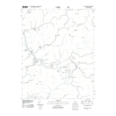
2011 Map of Elkhorn City
USGS Topo · Published 2011About this map
Elkhorn City serves as the focal point of this Pike County terrain, situated where the Russell Fork bends through a deep river gorge on the Kentucky and Virginia border. The settlement pattern here is dictated by the narrow valley floors, with small communities like Ferrell, Belcher, and Cedarville established along the winding waterways. Local history is preserved in numerous family-named burial grounds, including the Honey Fork Cemetery and Looney Cemetery, often tucked into small hollows like Song Hollow or near the high ridges of Card Mountain. The engineering required to navigate this landscape is evident in the presence of the Pool Point Tunnel, Towers Tunnel, and the Pool Point Bridge. Further south, the dramatic geologic formations of The Breaks and Lovers Leap overlook the river, marking the transition into the neighboring mountains of Virginia.
Find a feature on this map
135 named features on this map. Tap any name to fly to it.
Don’t see what you’re looking for? This feature index may not catch every label — zoom into the map to look around manually.
Map Details
Editions of this 2011 Elkhorn City Map
This is the sole edition of this map. No revisions or reprints were ever made.
Other maps of this area

1886 · Grundy
USGS Topo · 1:125,000

1890 · Grundy
USGS Topo · 1:125,000

1892 · Grundy
USGS Topo · 1:125,000

1913 · Clintwood
USGS Topo · 1:62,500

1914 · Bucu
USGS Topo · 1:48,000

1914 · Hurley
USGS Topo · 1:48,000

1915 · Clintwood
USGS Topo · 1:62,500

1915 · Regina
USGS Topo · 1:48,000

1915 · Hurley
USGS Topo · 1:48,000

1916 · Bucu
USGS Topo · 1:62,500