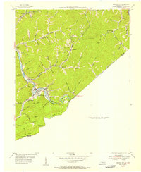
1954 Map of Elkhorn City
USGS Topo · Published 1955About this map
Elkhorn City serves as a critical junction in this 1950s study of the Kentucky and Virginia borderlands. The landscape is defined by the steep relief of Pine Mountain and the winding course of the Russell Fork, which carves through the coal-rich terrain of Pike County. The convergence of the Chesapeake and Ohio RR and the Clinchfield RR highlights the area's industrial importance, as these lines maneuver through deep hollows like Elswick Hol and across Beaver Bottom to transport resources from numerous Strip Mines scattered across the ridges.
Find a feature on this map
72 named features on this map. Tap any name to fly to it.
Don’t see what you’re looking for? This feature index may not catch every label — zoom into the map to look around manually.
Map Details
Editions of this 1954 Elkhorn City Map
This is the sole edition of this map. No revisions or reprints were ever made.
Other maps of this area

1886 · Grundy
USGS Topo · 1:125,000

1890 · Grundy
USGS Topo · 1:125,000

1892 · Grundy
USGS Topo · 1:125,000

1913 · Clintwood
USGS Topo · 1:62,500

1914 · Bucu
USGS Topo · 1:48,000

1914 · Hurley
USGS Topo · 1:48,000

1915 · Clintwood
USGS Topo · 1:62,500

1915 · Regina
USGS Topo · 1:48,000

1915 · Hurley
USGS Topo · 1:48,000

1916 · Bucu
USGS Topo · 1:62,500