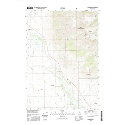
2017 Map of Elkhorn Creek
USGS Topo · Published 2017About this map
Thousand Springs Valley dominates the western portion of this 2017 survey, where a complex network of wetlands and seasonal water bodies defines the floor of this Custer County basin. The agricultural and ranching heritage of the region is evident in the layout of irrigation works like the Chilly Canal and ranch roads such as San Felipe Ranch Rd and Old Chilly Rd. These routes skirt the edge of the valley, connecting outlying areas like Barton Flats and Cedar Creek Bar to the larger landscape.
Find a feature on this map
31 named features on this map. Tap any name to fly to it.
Don’t see what you’re looking for? This feature index may not catch every label — zoom into the map to look around manually.
Map Details
Editions of this 2017 Elkhorn Creek Map
This is the sole edition of this map. No revisions or reprints were ever made.
Other maps of this area

1935 · MacKay
USGS Topo · 1:96,000

1935 · Borah Peak
USGS Topo · 1:125,000

1938 · Borah Peak
USGS Topo · 1:125,000

1940 · Mackay
USGS Topo · 1:62,500

1955 · Dubois
USGS Topo · 1:250,000

1955 · Idaho Falls
USGS Topo · 1:250,000

1958 · Dubois
USGS Topo · 1:250,000

1958 · Idaho Falls
USGS Topo · 1:250,000

1960 · Mackay
USGS Topo · 1:62,500

1960 · Copper Basin
USGS Topo · 1:62,500