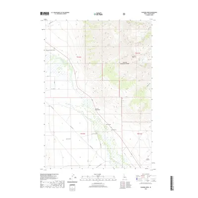
2020 Map of Elkhorn Creek
USGS Topo · Published 2020About this map
Thousand Springs Valley dominates the western portion of this Idaho landscape, where the Big Lost River winds through a complex hydrologic network of creeks and irrigation features. The intricate water management system is evidenced by the Chilly Canal and numerous springs, such as Whiskey Springs and Coyote Spring, which supported the early agricultural efforts of Custer County. To the east, the terrain rises sharply into the Lost River Range within the Challis National Forest, providing a stark contrast between the low-lying Barton Flats and high-altitude landmarks like Leatherman Pass and Merriam Lake. Transportation routes like the Old Chilly Rd and San Felipe Ranch Rd trace the edges of the valley floor, connecting historical ranching sites and remote settlements like Cedar Creek Bar at the base of the mountains.
Find a feature on this map
30 named features on this map. Tap any name to fly to it.
Don’t see what you’re looking for? This feature index may not catch every label — zoom into the map to look around manually.
Map Details
Editions of this 2020 Elkhorn Creek Map
This is the sole edition of this map. No revisions or reprints were ever made.
Other maps of this area

1935 · MacKay
USGS Topo · 1:96,000

1935 · Borah Peak
USGS Topo · 1:125,000

1938 · Borah Peak
USGS Topo · 1:125,000

1940 · Mackay
USGS Topo · 1:62,500

1955 · Dubois
USGS Topo · 1:250,000

1955 · Idaho Falls
USGS Topo · 1:250,000

1958 · Dubois
USGS Topo · 1:250,000

1958 · Idaho Falls
USGS Topo · 1:250,000

1960 · Mackay
USGS Topo · 1:62,500

1960 · Copper Basin
USGS Topo · 1:62,500