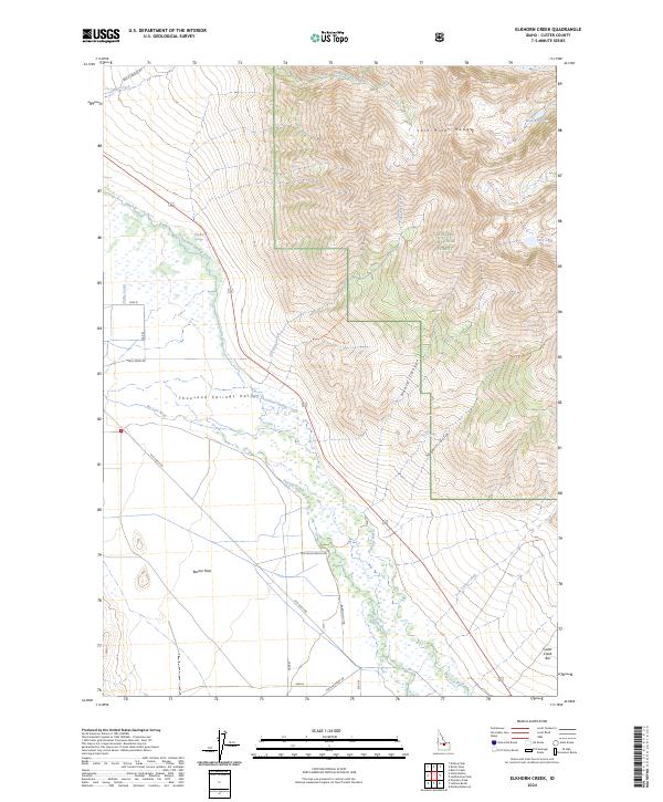
2024 Map of Elkhorn Creek
USGS Topo · Published 2024About this map
The Lost River Range dominates the eastern landscape of this Custer County quadrangle, where the high peaks of the Challis National Forest give way to the broad Thousand Springs Valley below. This survey captures a terrain defined by its water sources, from the alpine Merriam Lake and Pass Lake to the valley-floor network of Thousand Springs Creek and the Big Lost River. The presence of the Chilly Canal and various ranch roads, such as San Felipe Ranch Rd, illustrates the intersection of wild mountain topography with the irrigation and grazing needs of the valley. Local landforms like Barton Flats and the Cedar Creek Bar provide specific markers for those tracing family land use or local history in this part of Idaho. Notable landmarks like Whiskey Springs and Coyote Spring remain vital points of reference in this high-altitude environment.
Find a feature on this map
30 named features on this map. Tap any name to fly to it.
Don’t see what you’re looking for? This feature index may not catch every label — zoom into the map to look around manually.
Map Details
Editions of this 2024 Elkhorn Creek Map
This is the sole edition of this map. No revisions or reprints were ever made.
Other maps of this area

1935 · MacKay
USGS Topo · 1:96,000

1935 · Borah Peak
USGS Topo · 1:125,000

1938 · Borah Peak
USGS Topo · 1:125,000

1940 · Mackay
USGS Topo · 1:62,500

1955 · Dubois
USGS Topo · 1:250,000

1955 · Idaho Falls
USGS Topo · 1:250,000

1958 · Dubois
USGS Topo · 1:250,000

1958 · Idaho Falls
USGS Topo · 1:250,000

1960 · Mackay
USGS Topo · 1:62,500

1960 · Copper Basin
USGS Topo · 1:62,500