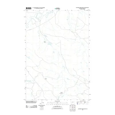
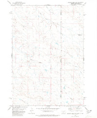
2011 Map of Elkhorn Creek West
USGS Topo · Published 2011About this map
The Little Missouri River meanders across the northern reaches of this Carter County landscape, marking a vital water source in the arid ranching country of southeastern Montana. The territory is defined by a dendritic network of drainages including Horse Creek, Elkhorn Creek, and Blacktail Creek, which carve through the plains. Ranching infrastructure is prominent, evidenced by small-scale water management projects like the Courtney Herefords Number 3 Dam and the J Oliver Number 1 Dam, highlighting the intersection of private agricultural needs and local geography. Transport through the area is maintained via established routes such as Camp Crook Rd and Albion Rd, which connect the isolated homesteads and grazing lands. The presence of the whimsically named Little Boy Blue Dam further illustrates the localized naming traditions of this rural prairie environment during the early 21st century.
Find a feature on this map
10 named features on this map. Tap any name to fly to it.
Don’t see what you’re looking for? This feature index may not catch every label — zoom into the map to look around manually.
Map Details
Editions of this 2011 Elkhorn Creek West Map
This is the sole edition of this map. No revisions or reprints were ever made.
Other maps of this area

1954 · Ekalaka
USGS Topo · 1:250,000

1956 · Ekalaka
USGS Topo · 1:250,000

1958 · Ekalaka
USGS Topo · 1:250,000

1965 · Ekalaka
USGS Topo · 1:250,000
1980 · Elkhorn Creek SW
USGS Topo · 1:24,000

1980 · Cactus Creek West
USGS Topo · 1:24,000

1980 · Finger Buttes East
USGS Topo · 1:24,000
1980 · Sevenmile Creek
USGS Topo · 1:24,000
1980 · Albion
USGS Topo · 1:24,000
1980 · Elkhorn Creek East
USGS Topo · 1:24,000