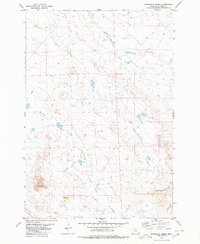
1980 Map of Sevenmile Creek
USGS Topo · Published 1980About this map
Flasted Ranch stands as a focal point of human habitation in this corner of Carter County, situated within a landscape defined by an intricate network of intermittent waterways. The terrain is dominated by the drainages of Sevenmile Creek, Ninemile Creek, and Fivemile Creek, which carve through the open country. To the southwest, the expansive Stoneville Flats provides a level break from the rolling topography, while a lone Pipeline and a Gravel Pit indicate the modern infrastructure and industrial activity present in the late 20th century. The presence of South Fork Owl Creek and Crow Creek in the southeastern quadrant further illustrates the drainage patterns essential to ranching in this part of Montana. This survey serves as a detailed record of land use and water resources in a region where life is closely tied to the natural hydrology of the plains.
Find a feature on this map
13 named features on this map. Tap any name to fly to it.
Don’t see what you’re looking for? This feature index may not catch every label — zoom into the map to look around manually.
Map Details
Editions of this 1980 Sevenmile Creek Map
This is the sole edition of this map. No revisions or reprints were ever made.
Other maps of this area

1901 · Aladdin
USGS Topo · 1:125,000

1903 · Aladdin
USGS Topo · 1:125,000

1954 · Ekalaka
USGS Topo · 1:250,000

1954 · Gillette
USGS Topo · 1:250,000

1955 · Gillette
USGS Topo · 1:250,000

1956 · Ekalaka
USGS Topo · 1:250,000

1957 · Mona
USGS Topo · 1:62,500

1957 · Colony
USGS Topo · 1:62,500

1958 · Gillette
USGS Topo · 1:250,000

1958 · Ekalaka
USGS Topo · 1:250,000